Log in to view full website content, join discussions, and to post information.
From Greg Beroza:
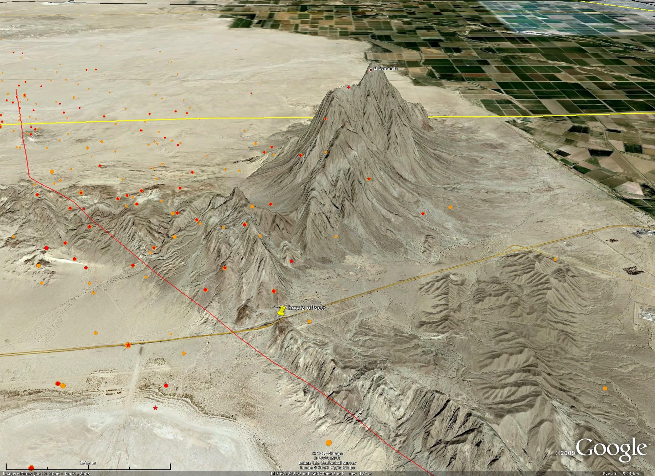
As of 8:15pm PDT on Monday, April 5th, 2010, the earthquake has been christened the Sierra El Mayor earthquake. SCEC geologists and geodesists are in the field now, to be followed tomorrow (Tuesday, April 6th) by seismologists. Surface rupture appears to extend across Highway 2, south of the border. Ken Hudnut is coordinating an airborne reconnaisance of surface rupture tomorrow that will provide important constraints on the distribution of faulting.
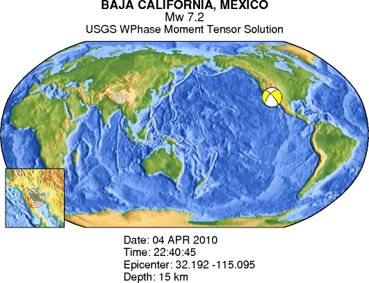
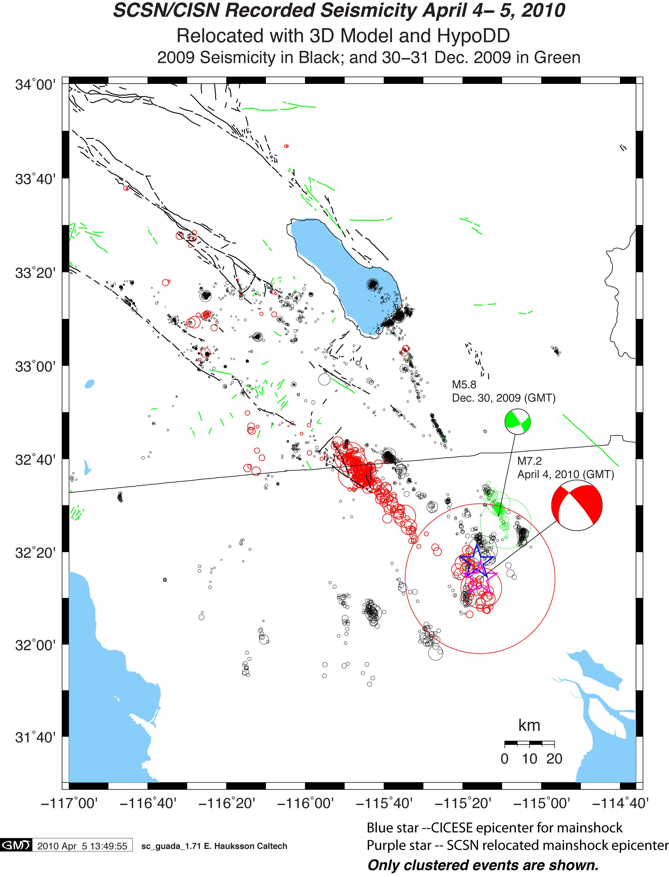
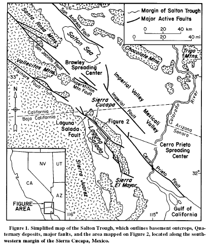
As of 10:30am PDT on Monday, April 5th, 2010, this is where things stand. The USGS has the earthquake at M 7.2 with a strike-slip mechanism, but with a normal-faulting component. It seems to be on/near the Laguna Salada fault, though that has not been confirmed by observations of surface rupture, so we should not be associating it definitively with that fault. Aftershocks extend to the US side of the border. The Laguna Salada fault had an earthquake of similar size in 1892 (Hough and Elliot, 2004 BSSA). We have made contact with colleagues across the border: Javier Gonzales is the contact for geodetic observations in Mexico, Victor Wong is the contact for seismological observations, and John Fletcher for geological observations. All of these scientists are at CICESE.
As of 8:15pm PDT, Sunday, April 4th, 2010 this is where things stand. The USGS has the earthquake at M 7.2 with a strike-slip mechanism. It seems to be on/near the Laguna Salada fault, which had an earthquake of similar size in 1892 (Hough and Elliot, 2004 BSSA). Today's earthquake has been a bit challenging having happened on Easter Sunday and just across the border. We have made contact with colleagues across the border, but it took awhile. SCEC is gearing up for possible seismic, geodetic, and geologic fieldwork, but how it goes from here depends strongly on what we learn about what is possible to carry out in Mexico. There also may be the issue that non-SCEC instruments are scattered far and wide: in Haiti and Chile. Mike Oskin has made contact with John Fletcher at CICESE (Ensenada), who is headed out to the field tomorrow and is interested in collaborations. I have also heard back from Carlos Valdes, who is head of the Mexican National Seismological Service. I let him know that scientists here are interested and available to collaborate and that we should try to coordinate our response. He has not yet managed to get throught to CICESE, but will be in touch with us tomorrow.
Attachments/Uploads
- Moment Tensor Solution
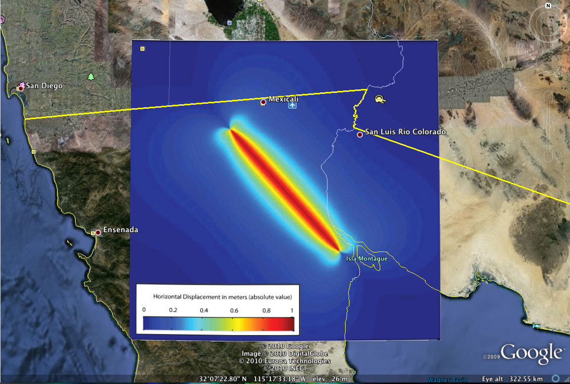
- Horizontal Displacements
- 1Hz Rinex Data
- SCEC -VDO Images (UCERF2 Faults, CFM 2.5 Faults, CFM 2.5 Faults (from the North))
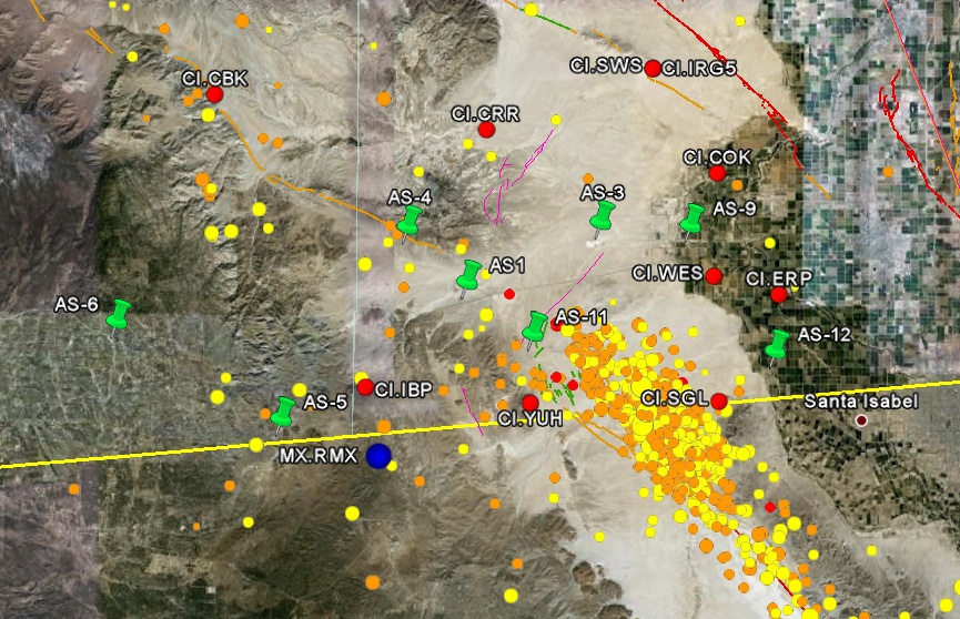
- Aftershock Zone and Active Faults (Bajaeq.png, Bajaeq.pdf)
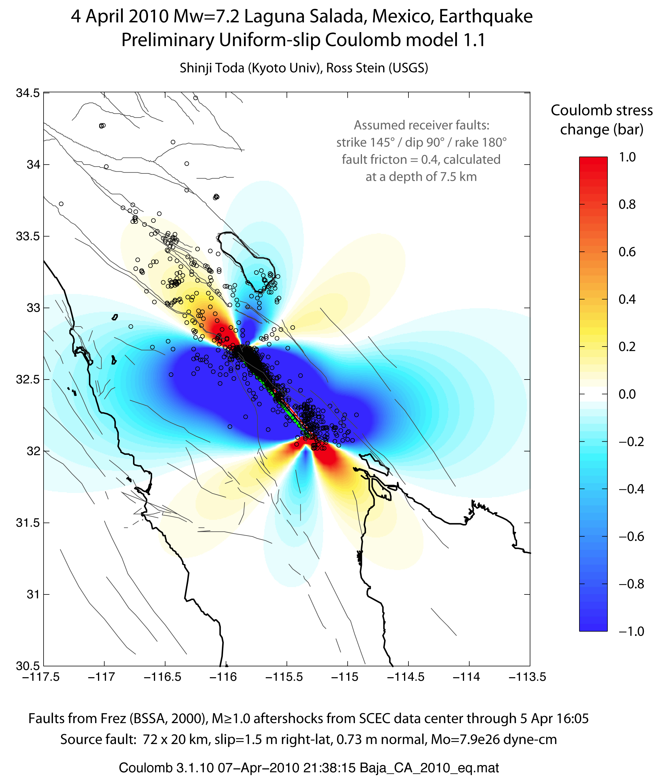
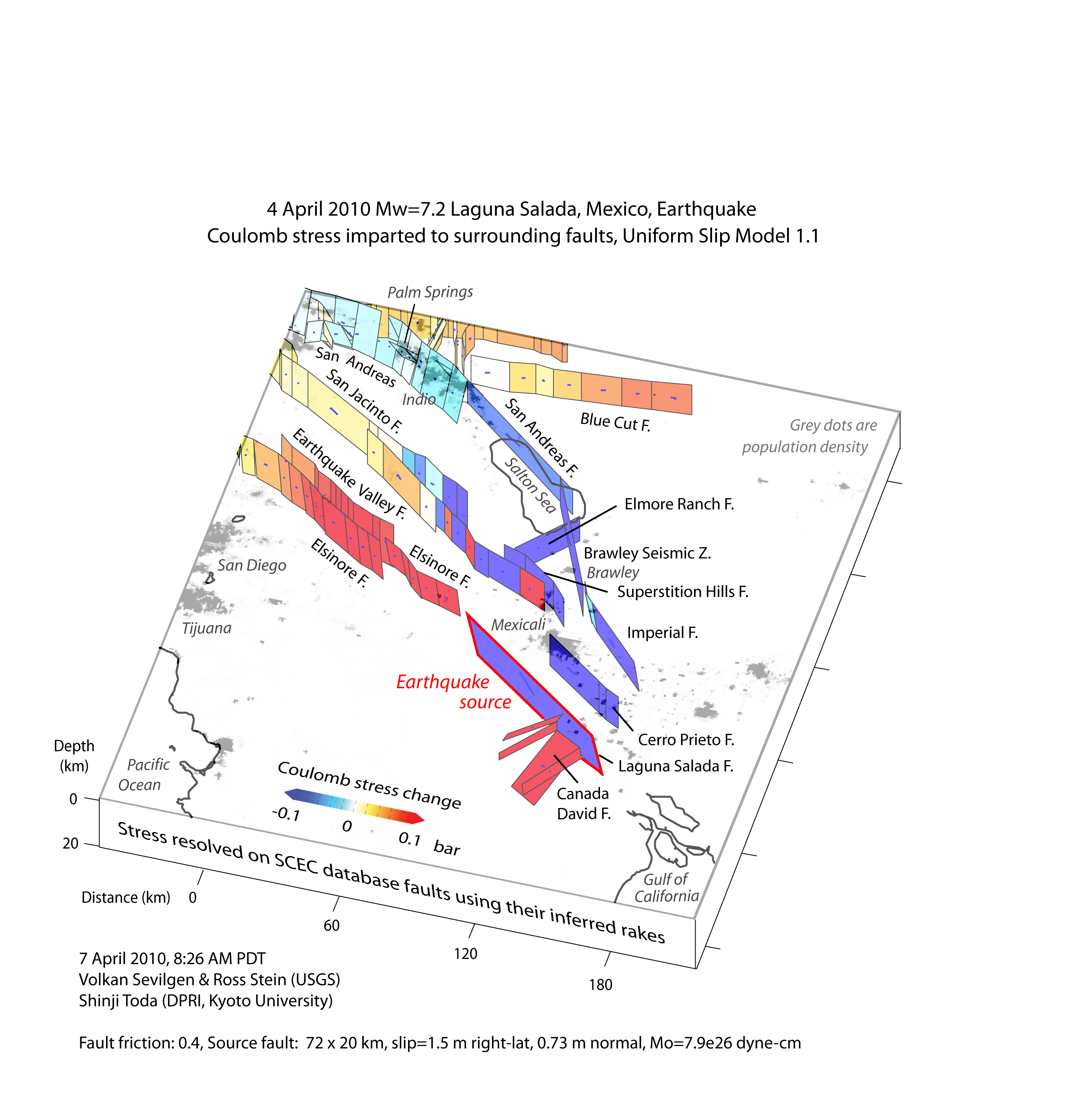
- Coulomb Stress Change (version: 1.0, 1.1) , Calculations (version: 1.1)
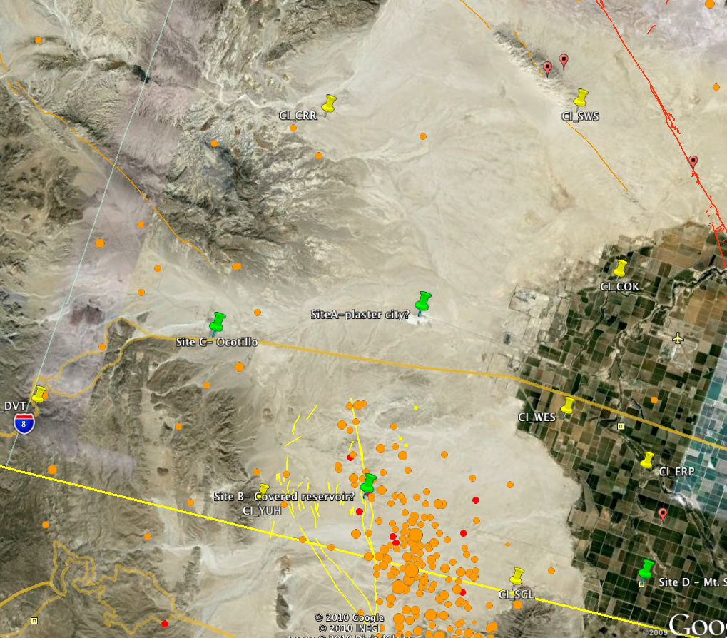
- Seismology Deployment-Potential Sites
- Seismometers South of the Border
- Map of IRIS-Passcal seismometers deployed in Mexico as of 4/9/2010 (from Raul Castro, CICESE)
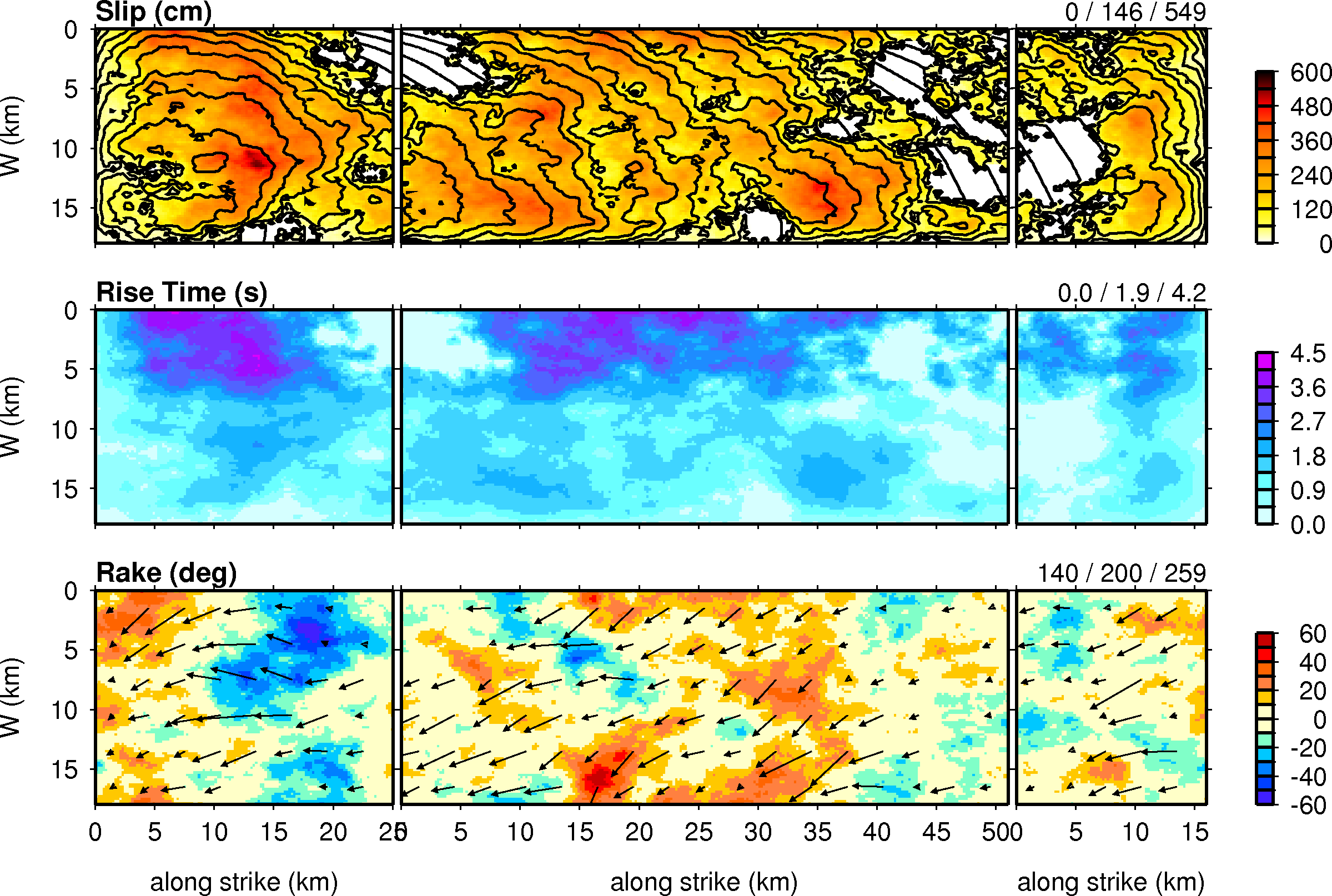
- Hypothetical Rupture Model (base_bc10.png, BajaCalif-s800.png)
- Catalog Completeness
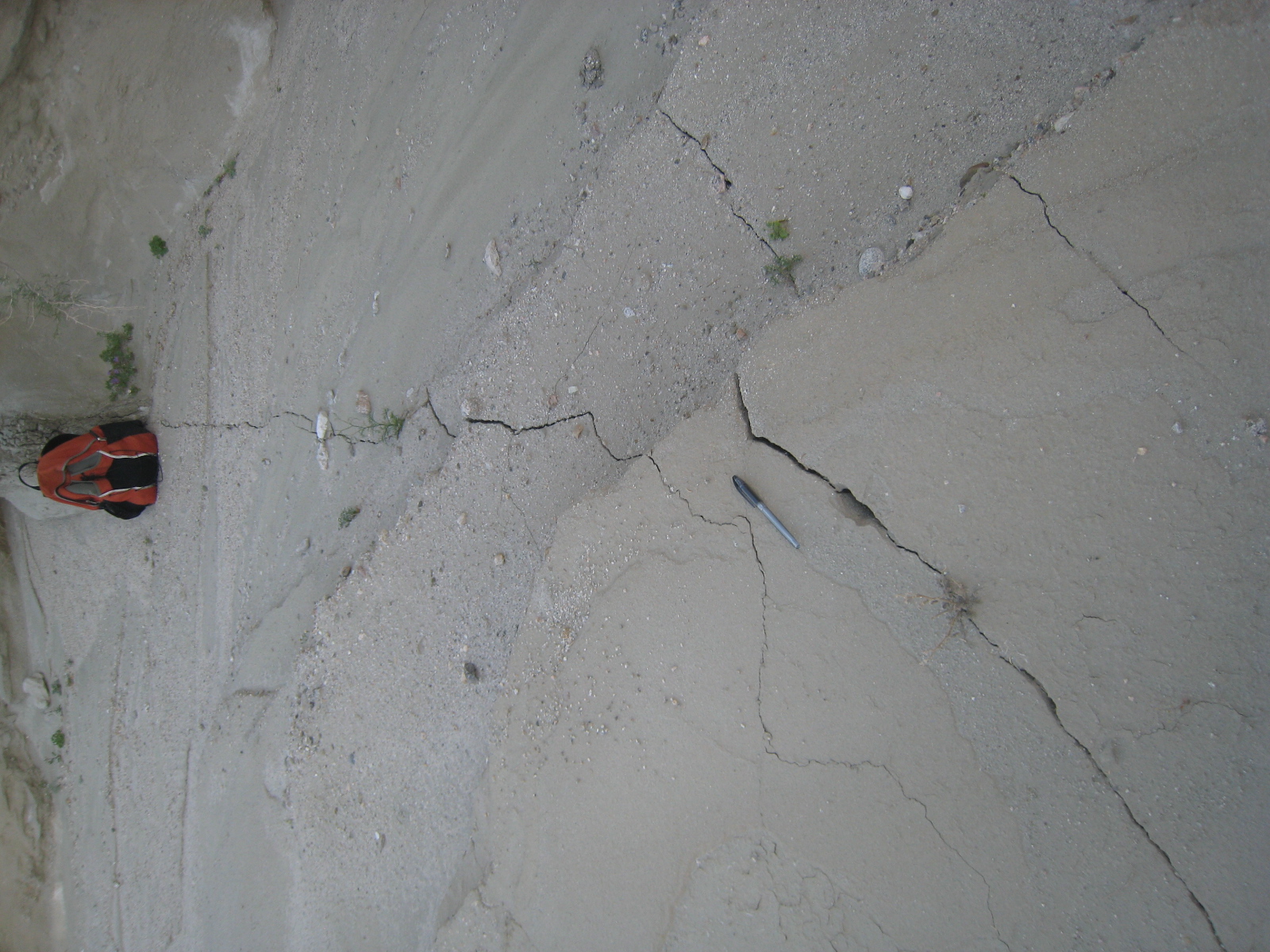
- Surface Faulting (Twitter Pic, centinela-offset-hwy-2.jpg, hwy-2-offset_v2.kml, IMG_0405.jpg, More Photos)
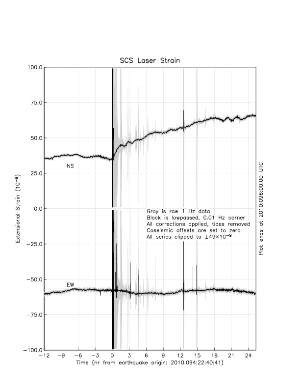
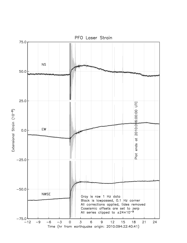
- Laser-Strain Data (salada.scslsm.png, salada.pfolsm.png, salada.dhllsm.png)
- UNAVCO Data & Equipment
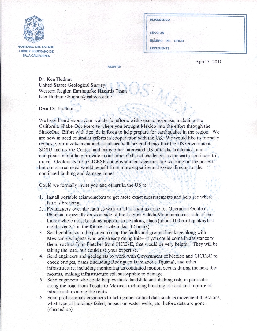
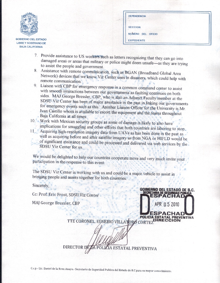
- Letter of Cooperation from Baja Government (scan-letter-pg1.jpg, scan-letter-pg2.jpg)
- Mueller and Rockwell (1995) (map and paper)
- Geodetic Coseismic Offsets
- Strong Motion Deployment
- KML with ShakeMap station data
- Active Faults East of Laguna Salada - Fletcher & Spelz
- Coseismic offsets from the CRTN ( .pdf, .vec )
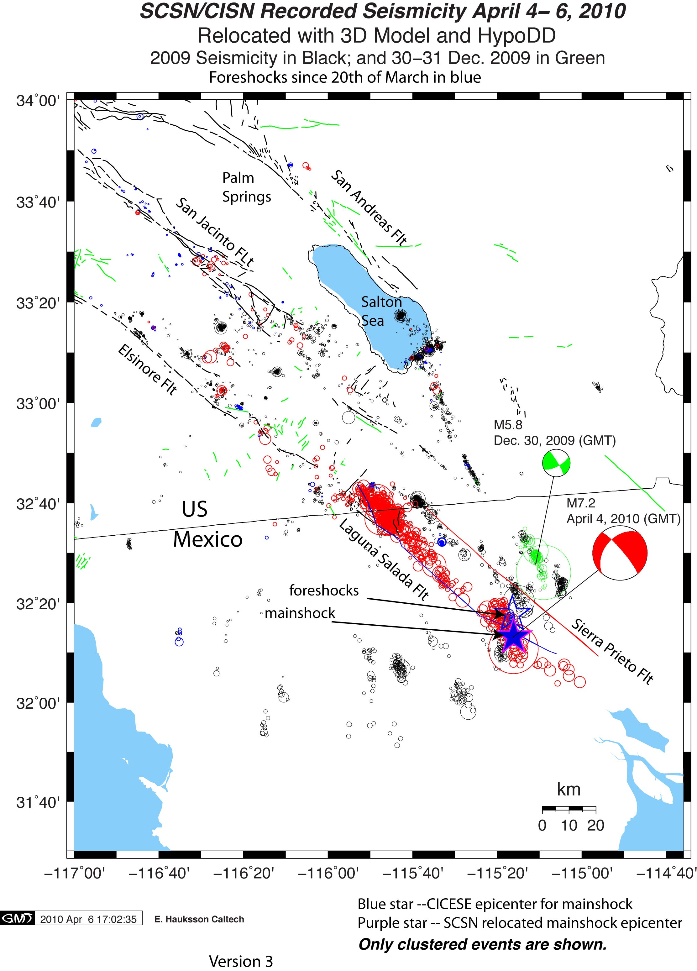
- SCSN/CISN Recorded Seismicity (April 4 - 6,2010)
- CRTN Displacement Movie (.mov)
- Airborne Reconnaissance Report - Photos, Maps
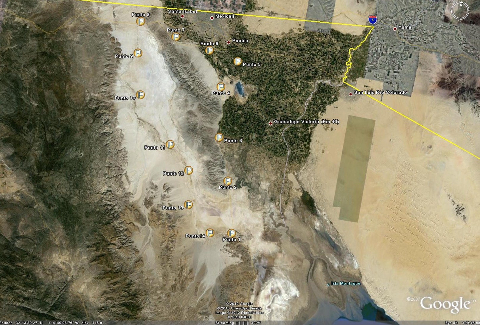
- Field Locations Reported (.kmz)
- Fletcher and Spelz Map with Borrego and Pescadoros faults (.kmz)
- Initial Lidar Plan (.jpg, .kmz)
- CI Broadband waveforms for M7.2 Event (.tar)
- Digitized Faults in the Sierral El Mayor and Sierra Cucapa (.kml, .txt)
- Paper on Active Structure on East Side of Sierra el Mayor
- 3D Ground Motion Simulation (.mov, .png)
- Login to post comments